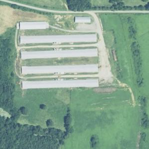
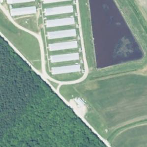
While the availability of raw satellite imagery has grown rapidly, there remains a dearth of ground truth labeled satellite data compared to other image domains. We hence present the North Carolina Concentrated Animal Feeding Operations (CAFOs) dataset (NC-CAFO). The NC-CAFO dataset includes hand-validated images of poultry and swine CAFOs and control images throughout the state of North Carolina from the US Department of Agriculture (USDA) National Agricultural Imagery Program (NAIP). These labels are based on a rigorous labeling protocol by a RegLab team of researchers, built on top of manual enumeration by the Environmental Working Group and the Waterkeeper Alliance. These images comprised the training and validation set for the deep learning methods described in Handan-Nader and Ho (2019). Any use of these data should cite the article as the source.
NC-CAFO includes:
- 21,768 image tiles (299 x 299) at 1 meter per pixel resolution from the 2014-16 NAIP release, downloaded in December 2017 using an API service provided by Descartes Labs.
- In the training set, 893 images substantially depict poultry CAFOs, 714 substantially depict swine CAFOs or their manure lagoons. Images not substantially depicting CAFOs were discarded. The test set contains 833 poultry images and 399 swine images, some of which are partially occluded (see Handan-Nader and Ho (2019) for explanation of image occlusion).
- Class labels for each image derived by our team of hand coders.
- Latitude and longitude coordinates of the image center (useful for cross-referencing with higher resolution imagery).
We note that these images are a non-random sample of the population of images in North Carolina. In the training set, control images at the classification boundary were oversampled to improve model performance, and CAFO images not substantially depicting the CAFO were discarded. The test set reflects the stratified sampling procedure described in Handan-Nader and Ho (2019).
Sample Images


References
Cassandra Handan-Nader, Daniel E. Ho, and Larry Y. Liu 2020. “Deep Learning with Satellite Imagery to Enhance Environmental Enforcement.” Data-Driven Insights and Decisions: A Sustainability Perspective (Jennifer B. Dunn & Prasanna Balaprakash eds.).
